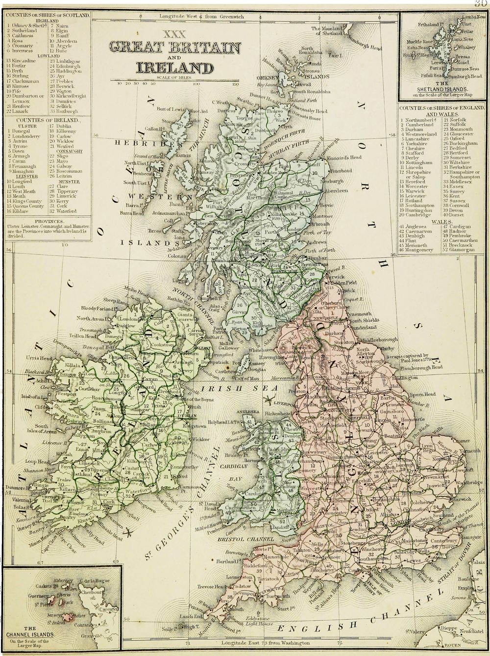
Antique Map Great Britain and Ireland 1865
Buy this print on Etsy →The islands of Great Britain and Ireland stand together on this 1865 map, drawn in the accomplished style of mid-Victorian cartography at the height of British power and printing. England, Scotland, Wales, and Ireland are laid out in fine detail, their coastlines firm and precise, their counties bordered and named, the whole archipelago rendered with the confidence of an age that mapped its home islands as carefully as it mapped its empire. Rivers, towns, and county boundaries thread across the sheet, capturing the British Isles as they looked in the middle of the nineteenth century.
This is engraving of real refinement. Victorian mapmakers combined clean, exacting linework with attractive decorative touches, and this map carries both: crisp coastlines, clearly delineated counties, and period hand coloring that separates each region in soft, distinct washes. It is the kind of map that hung in schoolrooms and studies alike, valued for its accuracy and admired for its craft, a portrait of the islands that felt at once scientific and quietly beautiful. To trace its shores and shires is to see Britain and Ireland as the Victorians knew them.
Our reproduction honors that character on museum-grade 189gsm archival matte paper, printed with pigment inks so the delicate engraving and hand-colored counties stay sharp and the antique tones stay true and fade-resistant for years. The matte surface is glare-free and paper-soft, faithful to the look of an original nineteenth-century sheet. This is a fine-art reproduction made for display, not an original antique map.
Five sizes are available: 8x12, 12x18, 16x24, 20x30, and 24x36 inches. Each print ships rolled in a protective tube and arrives ready to frame in the style you choose.
An antique map print of Great Britain and Ireland brings history and heart to a study, office, library, or living room, and a special meaning to anyone with roots in these islands. It is made for the collector of vintage cartography, the history enthusiast, and anyone who loves old world map wall art with a personal connection. Hang it as an elegant focal point, or anchor a gallery wall of historical map posters exploring the British Isles. Larger sizes make a handsome statement; smaller ones bring warmth to a shelf or hallway.
It makes a heartfelt gift for the Anglophile, the traveler, the genealogist, or anyone tracing family back to England, Scotland, Wales, or Ireland. This antique map poster carries the craft and confidence of 1865 into a modern room, a window onto the islands as the Victorians charted them.
Bring home this map of Great Britain and Ireland and let the four nations of the archipelago spread across your wall, their coastlines and counties a lasting reminder of the places, and perhaps the ancestry, that shaped so much history.