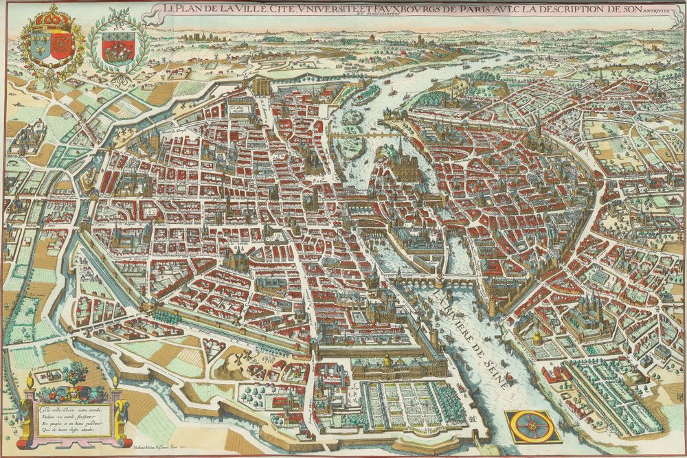
Antique Map Plan de Paris de Merian 1615
Buy this print on Etsy →Paris in 1615 rises from this bird's-eye plan as a walled city still bound by its ramparts, the Seine curving through its heart and the island cradle of the Ile de la Cite anchoring the center. This early seventeenth-century view, in the tradition of Matthaus Merian's celebrated city plans, sees the capital from above and slightly aslant, so that streets, bridges, churches, and gardens are drawn not as flat lines but as tiny standing buildings, a whole town rendered in miniature relief. It captures Paris on the cusp of its great expansion, before the boulevards, before the sprawl, when the city could still be taken in at a single glance.
The plan belongs to the golden age of copperplate engraving, when mapmakers doubled as artists and every rooftop, spire, and quay was incised by hand into metal. The perspective view was a specialty of the period, prized for turning geography into something almost tangible. A decorative cartouche carries the title, and period-style hand coloring warms the scene with soft washes that separate river from street and wall from field. The result is part map, part portrait of a living city.
Our reproduction is printed on museum-grade 189gsm archival matte paper with pigment inks, chosen so the delicate engraved detail and antique tones remain sharp and stable for years. The matte finish is glare-free and true to the character of old paper, letting you trace the narrow lanes and bridges up close. This is a fine-art reproduction made for display, not an original antique map.
Five sizes are offered: 8x12, 12x18, 16x24, 20x30, and 24x36 inches. Each print ships rolled in a sturdy tube and arrives ready to frame in your chosen style.
A vintage cartography print of Paris brings romance and depth to a study, a library, an entryway, or a Francophile's living room. It speaks to lovers of the city, students of history, and anyone who collects old world map wall art with a story. Hang it as a soulful centerpiece, pair it with other historical map posters of European capitals for a gallery wall, or set it near a bookshelf where its miniature towers can be admired. Larger sizes command a room; smaller ones make an intimate accent above a desk or console.
It is also a heartfelt gift, for the traveler who lost their heart to Paris, the couple who honeymooned there, or the history enthusiast who treasures the old world. This antique map poster carries the atmosphere of seventeenth-century France into a modern room, a keepsake of a city drawn when its story was still being written.
Let the Paris of 1615 unfold on your wall, its bridges, spires, and river a quiet invitation to imagine the streets as they once were and to walk them, in the mind, all over again.