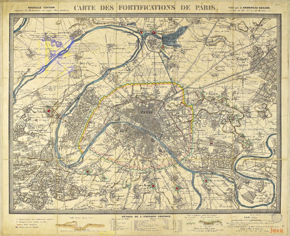
Antique Map Carte Des Fortifications de Paris 1832 1832
Buy this print on Etsy →The defensive geography of a great capital comes into focus in this 1832 map of the fortifications of Paris, a document from the era when the city debated how to gird itself against siege. Titled in French as a Carte des Fortifications, it traces the ring of ramparts, bastions, and defensive works proposed and built around Paris, the star-pointed geometry of military engineering laid over the familiar shape of the city and its surrounding villages. The Seine threads through the plan, the arrondissements cluster at its heart, and the fortified perimeter sweeps around them in the precise language of the engineer, a striking marriage of city and citadel.
Fortification maps hold a special place in the history of cartography, marrying urban geography with the exacting draftsmanship of military science. Engraved with fine, disciplined linework, they depict walls, ditches, gates, and glacis with technical clarity, while roads, rivers, and outlying communes locate the defenses within the living city. The restrained coloring and careful notation reflect the sober, functional aesthetic of the early nineteenth-century survey, a period when Paris was rethinking its boundaries and its security in a rapidly changing France. The result is at once a practical plan and an elegant study in geometry, every angle drawn with mathematical grace.
This is a fine-art reproduction printed on museum-grade 189gsm archival matte paper with pigment inks, chosen to preserve the fine engraved detail and measured tones of the original plan. The matte finish gives the print the quiet authority of an antique document, free of glare, while archival inks ensure it endures. It is not an original antique map, but a faithful reproduction of a fascinating piece of Parisian history. Each poster ships rolled and ready to frame, offered in five sizes: 8x12, 12x18, 16x24, 20x30, and 24x36 inches, from a compact accent to a large and detailed statement piece.
As antique map wall art, this plan of Paris and its defenses brings depth and intrigue to a study, office, library, or hallway, appealing to lovers of history, architecture, and the city itself. Its technical elegance pairs handsomely with modern and traditional interiors alike and adds a distinctive note to a gallery wall of vintage cartography. For the Francophile, the history buff, or the map collector, it makes a memorable gift for a birthday, graduation, or housewarming. A clean black or wood frame suits its engineered lines.
Hang it where its geometry can be traced, and this old world map wall art tells a lesser-known story of Paris, an absorbing historical map poster of a city drawing its own defensive lines around the capital of France. Part antique map print, part study in engineering, it offers something rarer than the usual old world map wall art, a piece that rewards the curious mind with a story most Parisians themselves have long forgotten.