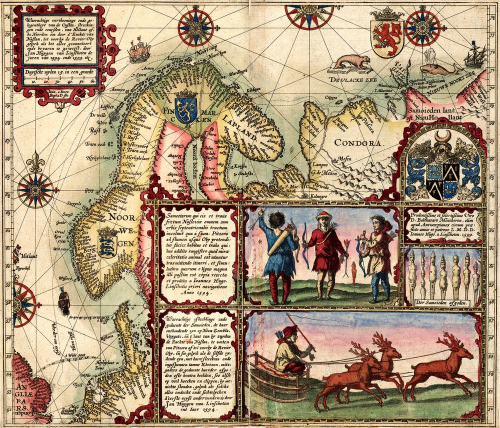
Antique Map Old Map of Norway 1601 1601
Buy this print on Etsy →Long before satellites traced its coastline, Norway was drawn as a land of deep fjords, jagged headlands, and cold northern seas. This reproduction of an old map dated 1601 carries you back to the dawn of the seventeenth century, when Scandinavia sat at the far edge of the known European world and cartographers rendered its shores with a mix of hard-won knowledge and imaginative flourish. The eye follows a ragged Atlantic coast broken by inlets, islands scattered like stepping stones across the water, and the interior filled with the engraver's careful hatching to suggest mountain and forest. Maps of this era belong to the great age of copperplate engraving, when every line, place name, and decorative border was cut by hand into a metal plate and printed one careful impression at a time. Latinized names, an ornamental cartouche, and a compass rose speak the visual language of early modern cartography, produced in the tradition of the Dutch and Flemish atlas workshops that dominated mapmaking around 1600. The result is both a navigational document and a work of art, a snapshot of how learned Europe pictured the northern kingdoms at a moment when exploration and commerce were reshaping the continent's sense of itself. Our print is a faithful fine-art reproduction, not an original antique map. It is produced on museum-grade 189gsm archival matte paper using pigment inks, so the aged tones, fine engraved lines, and subtle coloring are held with clarity and depth. The matte surface is free of glare and reads beautifully in natural or lamp light, while the archival materials mean the piece will resist fading and stay true for years. It arrives rolled in protective packaging, uncreased and ready to frame in the size you choose. Five sizes are offered, from an intimate 8x12 inches up to a commanding 24x36 inches, with 12x18, 16x24, and 20x30 in between. A smaller print brings quiet character to a bookshelf, entry nook, or reading corner, while the larger formats anchor a study, home office, or library wall with the gravity of an old chart. Norway's dramatic outline pairs naturally with Scandinavian and coastal interiors, and it makes a thoughtful gift for anyone who loves Nordic heritage, sailing, travel, or history. As antique map wall art, this Norway poster works as a striking standalone statement or as part of a curated gallery wall of vintage cartography, mixing effortlessly with other old world map prints and historical map posters. Whether you are drawn to the romance of early exploration or simply the beauty of hand-drawn geography, this seventeenth-century view of Norway offers a window onto a distant, storied north. Bring home the enduring appeal of vintage cartography and let this old map print spark curiosity and conversation in any room.