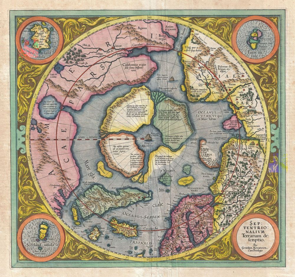
Pole 1606 Mercator Hondius Map of the Arctic First Map of the North Pole
Buy this print on Etsy →One of the most extraordinary maps in the history of cartography, this is the 1606 Mercator-Hondius map of the Arctic - the first map ever devoted to the North Pole. Engraved in the great tradition of Gerardus Mercator and published by Jodocus Hondius, it depicts the top of the world exactly as sixteenth-century geographers imagined it: four great islands ringing a central magnetic mountain, the fabled 'Rupes Nigra,' toward which the world's rivers and seas were believed to rush. Decorated with ships, sea monsters and ornate borders, it is equal parts science, myth and art.
In 1606, no European had ever seen the Pole, so Mercator filled the unknown with the best theories and legends of his day - which is exactly what makes this map so enchanting. It is a portrait of a world still full of mystery, drawn with breathtaking skill and imagination. The four islands, the swirling polar seas and the mythical black rock at the very centre have fascinated map lovers for centuries.
That blend of real cartographic mastery and pure fantasy is the map's enduring magic. It reads as both a serious historical document and a beautiful, dreamlike work of art - a genuine treasure of the golden age of exploration.
As wall art it is a spectacular talking point. The intricate detail and warm antique tones make it a natural for a study, home office or library, a living room or a gallery wall, and it suits classic, nautical, academic and eclectic interiors. It is a wonderful gift for map lovers, historians, explorers and anyone drawn to the romance of the Age of Discovery, and it pairs beautifully with other antique maps and celestial charts.
Because the original dates to 1606, it is firmly in the public domain, which is why we can reproduce it at full museum quality.
Each print is produced on premium 189 gsm museum-grade archival matte paper, faithfully capturing the fine engraved detail and warm antique tones of the original map - ready to frame and enjoy for years to come.