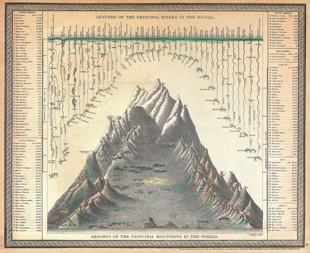
Antique Map 1850 Mitchell Comparitive Chart of the World Mountains and Rivers Io 1850
Buy this print on Etsy →Here is a map that measures the world rather than simply locating it. This 1850 comparative chart of the world's mountains and rivers lines up the great peaks of the earth by height and unspools its mightiest rivers by length, turning global geography into an elegant visual argument. Published in the mid-nineteenth century in the tradition of the American cartographer Samuel Augustus Mitchell, it belongs to a beloved genre of Victorian thematic charts that made science beautiful and knowledge collectible for the parlor and the classroom. Read it and you travel the planet by measurement: snow-capped summits ranked in ascending tiers, tiny figures and structures marking altitude, and sinuous rivers drawn side by side as if straightened out for comparison. This is antique cartography in its most ambitious, encyclopedic mood, a period when publishers distilled the fruits of global exploration into a single engraved sheet. The steel-engraved lines and gentle hand-applied coloring typical of Mitchell's atlases give the chart both precision and warmth, while its diagrams and keys reflect the confident, data-loving spirit of the age. Our print is a faithful fine-art reproduction, not an original antique map. It is produced on museum-grade 189gsm archival matte paper using pigment inks, so the delicate engraved detail, the ranked peaks, and the soft period tints are rendered crisply and richly. The matte finish is glare-free and holds up beautifully under natural or artificial light, and the archival paper and pigments are chosen to resist fading over time. It ships rolled in protective packaging, ready to frame in the size that suits your space. Choose from five sizes, spanning a compact 8x12 inches to a bold 24x36 inches, with 12x18, 16x24, and 20x30 options between. The smaller prints suit a desk, shelf, or intimate reading corner, while the larger sizes command attention above a mantel or across a study or library wall. Because the chart reads like an infographic, it is a natural fit for anyone fascinated by mountains, rivers, geology, exploration, or the history of science, and it makes a distinctive gift for teachers, travelers, and lifelong learners. As vintage cartography, this comparative chart shines as a conversation-starting centerpiece or as one panel in a gallery wall of old world map prints and historical map posters. Its rhythmic columns of peaks and ribbons of rivers bring pattern and movement to a wall, mixing well with other antique map prints or standing confidently on its own. Part science, part art, this nineteenth-century chart celebrates the era's hunger to measure and compare the whole world at a glance. Bring home a piece of that boundless curiosity and let this old map poster turn any room into a place of wonder, learning, and quiet discovery for years to come.