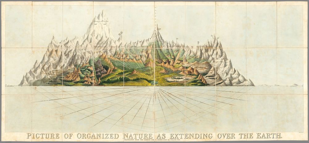
Antique Map 1828 Charles Smith Picture of Organized Nature As Extending Over the Earth 1828
Buy this print on Etsy →This is a map of life itself, spread across the surface of the earth. Charles Smith's 1828 "Picture of Organized Nature as Extending Over the Earth" is a thematic chart from the great age of scientific illustration, translating the newborn field of biogeography into a single luminous sheet. Instead of borders and cities, it maps the living world, showing how plants and animals arrange themselves by climate, latitude, and altitude, from tropical lowlands to the frozen limits of the poles and the thin air of mountain summits. Charts like this flourished in the early nineteenth century, inspired by the explorer-naturalists who traveled the globe measuring, collecting, and comparing. Produced in the London publishing tradition around 1828, the sheet layers mountains, climate zones, and bands of vegetation into a grand visual synthesis, the kind of ambitious diagram that hung in studies and schoolrooms as both instrument and ornament. The engraved detail and delicate hand coloring characteristic of the period lend it a jewel-like quality, blending the rigor of antique cartography with the beauty of natural history art. Our print is a faithful fine-art reproduction, not an original antique document. It is produced on museum-grade 189gsm archival matte paper using pigment inks, so the fine engraving, the gradations of climate and altitude, and the soft period palette are captured with clarity and depth. The matte surface resists glare and looks rich in any light, while the archival paper and pigment inks are made to hold their color and resist fading for the long term. Each piece ships rolled in protective packaging, uncreased and ready to frame in your chosen size. Five sizes are available, from a modest 8x12 inches to a statement-making 24x36 inches, with 12x18, 16x24, and 20x30 in between. Smaller formats bring quiet intrigue to a shelf, desk, or reading nook, while the larger sizes hold a wall in a study, home office, library, or laboratory with real presence. This chart is a natural choice for lovers of botany, zoology, geography, and the history of science, and it makes a memorable gift for naturalists, educators, students, and the endlessly curious. As vintage cartography and natural-history art, this poster works beautifully on its own or woven into a gallery wall of old world map prints and historical map posters. Its bands of climate and life bring color, structure, and a sense of exploration to any space, pairing easily with other antique map prints or botanical and scientific plates. More than a map, it is a portrait of the whole living planet as the nineteenth century first dared to picture it. Bring home this old map poster and let its vision of organized nature invite wonder, study, and conversation wherever it hangs.