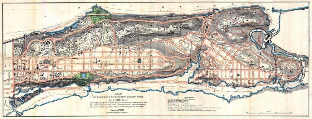
Antique Map 1870 Knapp Map of Northern Manhattan New York City Harlem Washington Heights Inwood Geographicus Northernmanhattan Knapp 1870 -
Buy this print on Etsy →Uptown Manhattan comes alive in this detailed 1870 map of the island's northern reaches, charting Harlem, Washington Heights, and Inwood in the years when the grid was still meeting open ground. Drawn in the tradition of the surveyor Knapp, it captures a city on the move, with laid-out streets and projected avenues threading between shorelines, ridges, and the last green stretches of upper Manhattan before the metropolis fully arrived. For anyone who loves New York, it is a portrait of neighborhoods on the cusp of transformation. Maps like this belong to the great era of nineteenth-century urban cartography, when growing American cities were surveyed block by block for developers, residents, and municipal planners. The sheet's precise linework, numbered plots, named streets, and careful rendering of waterways and terrain reflect the practical, document-driven mapmaking of the period. Where earlier antique maps favored ornament, this one prizes information, yet its dense detail and handsome engraving give it a beauty all its own, a working map that reads today like a time capsule of a young and expanding city. Our print is a faithful fine-art reproduction, not an original antique map. It is produced on museum-grade 189gsm archival matte paper using pigment inks, so the fine street detail, the tiny type, and the subtle period tones stay sharp and legible at every size. The matte surface is glare-free and looks handsome in any light, and the archival paper and pigment inks are selected to resist fading over the years. Each poster ships rolled in protective packaging, uncreased and ready to frame in the size you prefer. Five sizes are offered, from an intimate 8x12 inches to a bold 24x36 inches, with 12x18, 16x24, and 20x30 between. Smaller prints add character to an apartment gallery, hallway, or bookshelf, while the larger sizes make a commanding centerpiece in a study, office, or living room. This map is an ideal gift for New Yorkers, history buffs, Harlem and Heights residents, real-estate lovers, and anyone with a connection to upper Manhattan, offering the pleasure of finding a familiar street as it looked more than a century and a half ago. As antique map wall art, this Northern Manhattan poster stands strong on its own or joins a gallery wall of vintage cartography, city plans, and old map prints. Pair it with other historical map posters or vintage New York memorabilia and photographs for a layered, storied look. Whether you grew up uptown, live there now, or simply love the deep history of the city, this old map print connects you directly to the streets beneath your feet. Bring home an authentic piece of nineteenth-century New York and let this vintage cartography spark memories and lively conversation in any room.