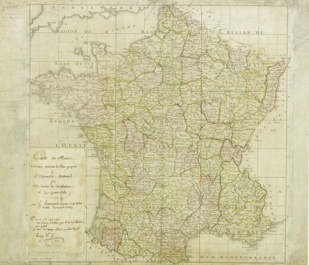
Antique Map Map of France After the Revolution in 1789
Buy this print on Etsy →France stands remade in this map of the nation after the Revolution of 1789, a country in the very act of reinventing itself. Swept clean of the old provinces, the kingdom was reorganized into the new rational grid of departments, and this map captures that historic transformation, tracing fresh boundaries across the familiar shape of France from the Channel coast to the Mediterranean and the Alpine frontier. It is geography as political revolution, a map that shows a nation rewriting its very structure. Maps of this late eighteenth-century moment belong to the era of copperplate engraving, when boundaries, rivers, mountains, and towns were cut by hand into metal and printed with fine, exacting lines. The reorganized departments, often distinguished by delicate hand coloring, reflect the sweeping ambitions of the revolutionary age to remake society along orderly, uniform principles. A title cartouche and carefully engraved place names root the sheet in the visual tradition of early modern cartography, even as its content announces the arrival of a new political world. The result is both a beautiful antique map and a document of one of history's great turning points. Our print is a faithful fine-art reproduction, not an original antique map. It is produced on museum-grade 189gsm archival matte paper using pigment inks, so the fine engraving, the tinted departmental boundaries, and the soft period tones are captured with clarity and richness. The matte surface resists glare and reads beautifully in any light, while the archival paper and pigment inks are selected to hold their color and resist fading over time. Each poster ships rolled in protective packaging, uncreased and ready to frame in the size you prefer. Five sizes are available, from a compact 8x12 inches to a bold 24x36 inches, with 12x18, 16x24, and 20x30 in between. Smaller prints bring character to a desk, hallway, or reading corner, while the larger formats make a striking centerpiece in a study, office, or library. This map is a thoughtful gift for Francophiles, history students, travelers, and anyone captivated by the drama of the French Revolution and the making of modern France, offering endless detail to explore across its regions and rivers. As vintage cartography, this revolutionary-era map of France works handsomely on its own or as part of a gallery wall of old world map prints and historical map posters. Pair it with other antique map prints or French decor for a layered, storied look full of history. Whether you love France, the Revolution, or simply the beauty of hand-engraved geography, this old map print connects you to a pivotal chapter in the nation's story. Bring home this antique map wall art and let a reborn France bring depth and conversation to your space.